Salinization of critical groundwater reserves in coastal Mediterranean areas: Identification, Risk Assessment, and Sustainable Management with the use of integrated modeling and smart ICT tools
The MEDSAL Project aims to secure the availability and quality of groundwater reserves in Mediterranean coastal areas, which are amongst the most vulnerable regions in the world to water scarcity and quality degradation.
MEDSAL aims to provide a novel holistic approach, towards the sustainable management of coastal aquifers, which are affected by increased (single or multi-source) groundwater salinization (GWS) risk, especially under the variable meteo-climatic conditions of the Mediterranean and the rapidly changing socio-economic context.
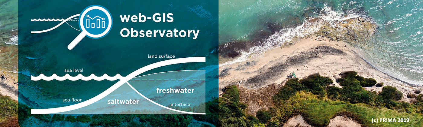
It is evident that salinization limits and menaces the availability of groundwater resources in the most populated and productive coastal areas of the Mediterranean. As a phenomenon, the salinization of coastal aquifers is a complex process often related to multiple causes such as lack of internal drainage, seawater intrusion, increased evaporation of water-logged areas, up-coning of deep-brines by over-abstraction, geogenic factors (e.g. evaporite dissolution, etc) and pollution.
The MEDSAL project team aims at improving the identification, detection, classification, modeling and risk assessment of salinization in the Mediterranean.